Walking mankind conquered the World, even in recent times uncharted territory at both Poles and highest mountain tops could only have been tamed by Foot. My ambitions in this field are far more modest - considering every single square metre on earth has already been trampled on - however my own small walking-projects allow me once-in-a-while to fully appreciate our living-space, and enjoy meditation on the road. One of these assigments is to walk SGR-12 (Sentier du Grande Randonnée) North2South from Brussels to Paris in bits & pieces, according to time allowed by available holidays. Follow this hyperlink for my account on the previous 2 voyages in 2005 & 2006. This current journal-entry is dedicated to my 2007-attempt, when I expected to finally reach the city of Lights, but I called it a day - or rather a week - ending in Soissons.
Day 3.1 - Sunday 29th April 2007 - Start in Rimogne
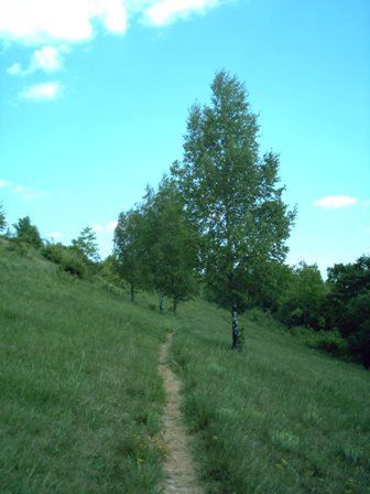
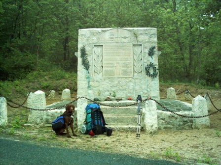
Picked up the GR12-trail again in Rimogne (France - Departement "Ardennes" - Region "Champagne-Ardennes") in direction of Paris, close to Montcornet where I ended year before in 2006. Passed Le Châtelet, Murtin-et-Bogny, Remilly-les-Pothécs, Rouvroy-sur-Audry to halt before Veux-Villaine (daily total of 15 km).
Shanshan - my helpful wife - was going to drop me by car in Montcornet - last year's terminus - so I fixed our GPS on Montcornet as target destination. Always dangerous to rely a bit too much on these electronic gadgets, because we drove into Montcornet in l'Aisne, a village listening to the same name 80 kilometres towards the West. No worries, so I simply hit the trail South-South-West a bit later at 2 o'clock after a drink & snack in "Mon Idée" (where ironically the waitress came from Holland). Actually I joined the GR-12 in Rimogne, because last year I took the variant GR12C at "Lac des Vieilles Forges" to pass Montcornet direction Charleville-Mézières. Five minutes after waving goodbye, as if to indicate that we were still too washed & clean, Keanu - my accompagnying dog - rolled himself over in the dust, so he & his backpack already blended in well with the outdoor environment. A thunderstorm caught up with us after climbing out of the valley of the l'Audry, but curiously enough no single drop of water refreshed us, as all Wind & Lightening preferred to stay below. At some point an overfriendly guy started to brabble to me in broken English - mixing with the words "belle femme" - but I had no idea what message he wanted to convey ... sure I guess I will see pretty women once I arrive in Paris? Then suddenly I realised that this track of the GR-12 runs along the GR-654 to Santiago de Compostella, so probably he was referring to the Holy Mary, at which point we laughingly continued our conversation in proper French. All activity ended at 19:30, when we seek refuge in plain forrest near Villain.
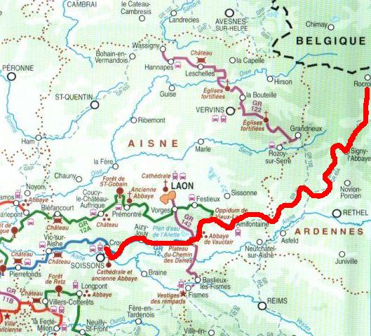
A machete might become handy
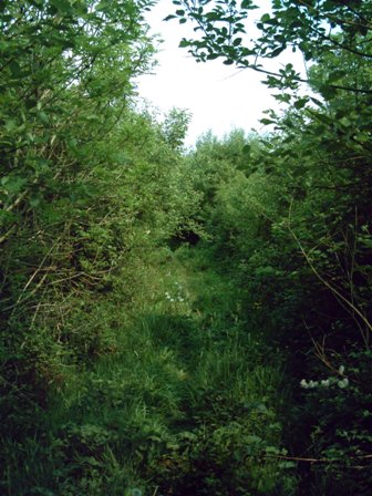
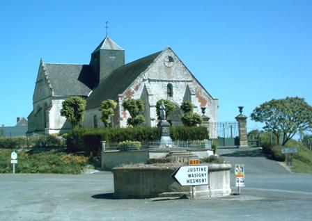
Typical 2-tower Church at Rouvroy-sur-Audry
Day 3.2 - Monday 30st April 2007 - Veux-Villaine to Lalobbe
Passed Signy-l'Abbaye and its Forêt Dominial (daily total of 20 km).
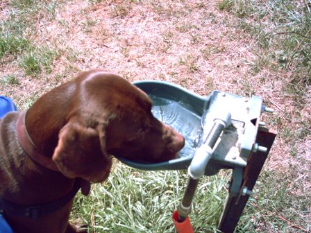
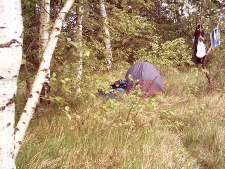
We replenish our water supplies in a nicely restored "lavoir" annex source in Veux-Villaine. Afterwards the path often leads through freshly ploughed fields - only scarce white-red markings indicate that I am correct - so I am wondering if those farmers accepts all these guests crossing their land. Throughout history travellers & settlers (think about cowboys & farmers during the 18th & 19th century in Western USA) have been sworn enemies, so I am simply extending the tradition, trying not to cause excess damage to the crops. The weather is ideal for walking when I approach Signy-l'Abbaye, and take an afternoon nap under a lavish "Calvaire" which was "erigé primimitivement par les moines de Signy et restauré ... par ... son eminance le cardinal Luçon". The instruction read "S. Michel prier pour nous (5 fois)" but both me & Keanu felt no urge to reach further to heaven. Late afternoon we also crossed the only multi-day walkers we would meet during the entire trip, which were on their courageous but endless way to Spain. We setup camp for the night between the "Gites" and Lalobbe, leaving the rooftop open to gaze to the moon & stars.
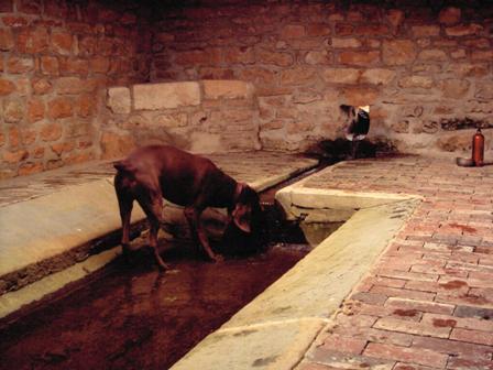
Nicely restored "lavoir" in Veux-Villaine
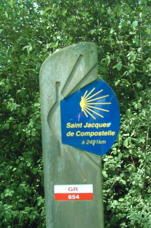
Saint Jacques still 2491 kms to the South ...
Calvaire North of Signy-l'Abbaye
Sarko or Ségolène?
Ancient Town Hall
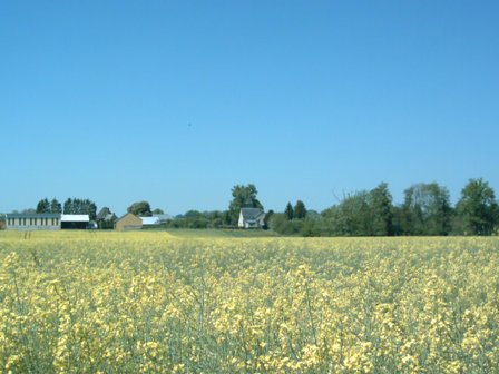
Yellow Ambience
Day 3.3 - Tuesday 1st May 2007 - Lalobbe to Son
Via Wasigny, Justine-Herbigny, Sery and Hauteville (daily total of 18 km).
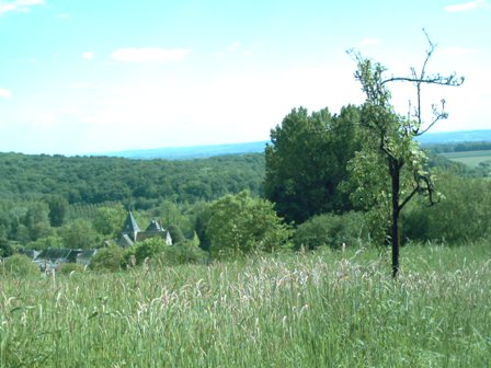
Labour Day, so we slept late until 9 and were only ready at 10 o'clock, enjoying breakfast & nice coffee. At a T-junction after Hauteville - in the middle of no-where - we had to leave the GR-654 turning right. Without map & compass we would really not have known, because they obviously ran out of paint for the markings. In one of those Lilliput towns incredibly old-fashioned lady's underwear was drying in the laundry before the "Marie", so I presume the town hall didn't only shelter administrative matters. All forrest had given way to open field, and with the strong sun - and no sun-cream - I got slowly backed. Otherwise Keanu is all energy - but he was slowly breaking down - so I carried his bags on top of mine. Passed Son the local farmer-community fancied a pittoresque little artificial lake - surrounded by high trees and a couple of benches - ideal spot for a smooth landing.
La Neuville-les-Wasigny if I am not mistaken
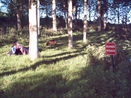
Great spot near Son "Baignade Interdite" but no-one said anything about camping ...
Peace at last
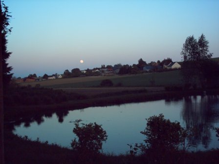
Sunset over Son
Day 3.4 - Wednesday 2nd May 2007 - Son to la Malmaison
Wide-open fields, except le Thour (daily total of 26 km).
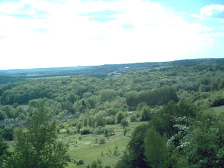
Today we definitely swapped from map 05 "Charleville-Mézières" to 10 "Reims", as the path had been stitching both maps together swaying North & South. Since there was no Topo-Guide covering this terrain, so far we have been walking on "overview" maps on a scale of 100:000, which is very frustrating on foot, because you hardly notice any progress (1 cm = 1 kilometre). Despite the early start and the fresh cool morning breeze, without shelter we got baked once more. At Saint Fergeux I took care of Keanu who got wounded at his chest. The designer of the dog-backback - which I bought in Seattle - was not very intelligent, since the belts in the front were joined by a triangle pointing upwards, which constantly rubbed deep into the skin of the poor animal. With some needle, thread and a dirty t-shirt which I decided to sacrifice, I manifactured a protective layer over the triangle, with the intention to change it into a pointless ring once we were home again. After Tor Keanu refused to carry on, so in dispair we just sat down for a couple of hours near the road. Then I dragged him until a large farm "Frontigny", were I had a nice chat with the farmer, so he could rest some more. The man offered me to sleep in the barn, but his dogs went all crazy with mine, so I simply filled up the water bottles and continued into the fields, where I set up camp in an area full of foxes.
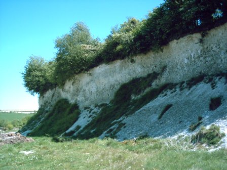
Looks like rocks of chalk, quite some houses have been built out of this white stone
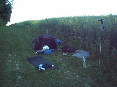
Hopefully no tractors will pass the morning after
Day 3.5 - Thursday 3rd May 2007 - la Malmaison past Aubigny-Laonnois
Entering "TopoGuides de Picardie" at Amifontaine, finally forest re-emerging at Goudelancourt-les-Berrieux, Camp des Romains (Vieux Laon) to stop N44 Loan-Reims (daily total of 20 km).
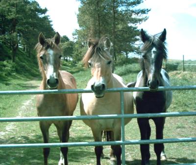
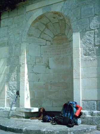
That morning we got violently woken up by an army of crows generating more noise together than a heavy metal band, and no shouting helped to calm them down. At Amifontaine - after la Malmaison (where I hand-washed my dirty clothes) - at long last I could start using the TopoGuide, and on top of that at Goudelancourt we entered cool fresh forest. Before leaving I had conveniently cut out only the page I needed out of the Guide, so we had all documentation handy. Only disadvantage is that we were following the description backwards, because it went from Senlis near Paris to Amifontaine. One of the first sights was the "Oppidum de Vieux-Laon" - a village of the iron age - but only high earth mounds were left. Judging from the size of the enclosure it must if been relatively big and populated though. Quite funny when the road crossed an area where horses were roaming free, following us and especially Keanu's bag full with smelly dog-cookies. During this trip Keanu also developed a remarkable sense for comfortable and shady resting spots, so we rested in Aubigny near a dripping fountain. Around 19:00 we stopped at a nice camping place, even though the highway was within hearing distance.
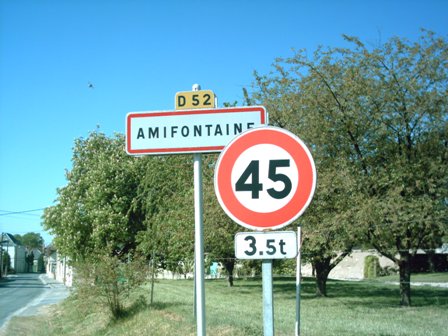
Amifontaine, where the Topo-Guide starts and the endless fields end
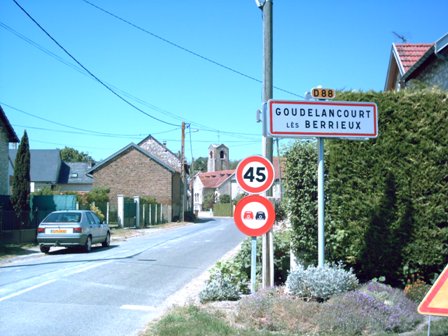
Goudelancourt les Berrieux, one of the cutest villages I encountered during this trip
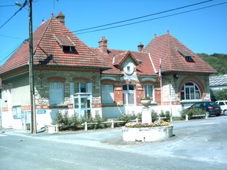
A cute village must have a cute "Marie"
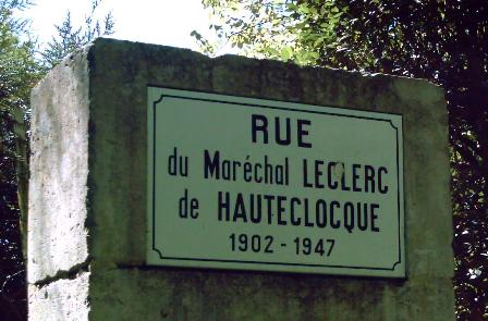
The Rue du Maréchal Leclerc de Hauteclocque was the only street in Goudelancourt les Berrieux as far as I could see, probably it's so quiet because no-one can remember all these long place-names
Our hosts in "Vieux Laon"
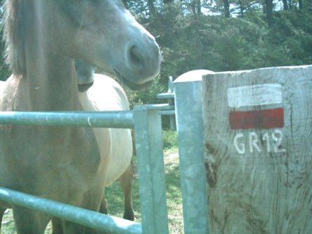
Indeed climb the fence to continue on the GR12
Horse & Dog Bar
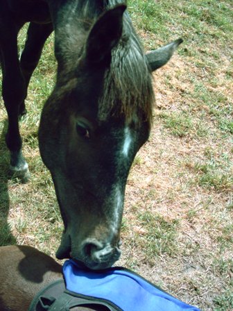
"Why don't you share some those cookies which I smell in your bag?"
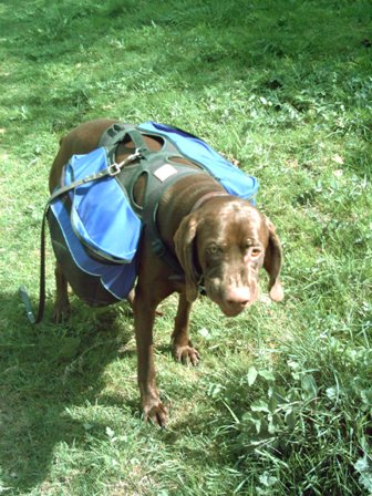
Keanu turns vegetarian - eating grass - under influence of the horses
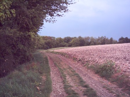
That's my type of road
View from "l'oppidum de Vieux-Laon" dominating the South
Tiny village of St. Thomas peeping through the bushes
Day 3.6 - Friday 4th May 2007 - Aubigny-Laonnois past Vendress-Beaulne
Crossing Forêt Vauclair and its Abbaye, Parc Nautique de l'Ailette nearby but not in view (daily total of 18 km).
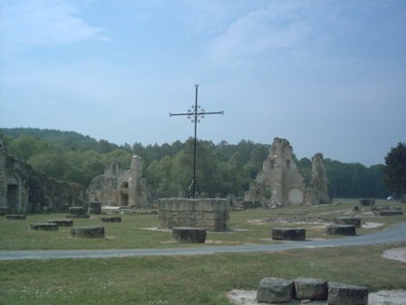
Clouds & dew were turning the morning shivery, hard to get up & dressed, but excellent for marching. A young farmer passed by on a quad-motorcycle - friendly but reserved - anyway he did not chase me away from his field. At Vouconville-Vauclair I decided to spoil myself - living on biscuits, sausage and self-cooked simple meals - and go to a restaurant. It took half an hour before anyone showed up, so I made myself comfortable, and enjoyed and white wine + juicy steak in "creole" style, because the cook/waiter obvioulsy came from the "provinces outre-mer". A bit further down the road - with my stuffed stomach - I wandered through the impressive ruins of "l'Abbeye de Vauclair", a Cisterian Abbey which got destroyed in 1917 during WO-I. We crossed the Forêt Vauclair, got a rain-shower once we're in the open field, and continued over what is know as "le chemin des dames". When I asked for water in Vendresse-Beaulne, a hospitable farmer invited me inside in home. Turns out he's originally from Poland, fought in Algier and married a Belgian wife from Kortrijk. Amazingly enough he's very fond of Belgians, and admires their working spirit. Then he start inspecting the dog, my backpack etc ... thus really winding up Keanu, who almost trashed the kitchen, which for some reason they still find very funny. Then I said goodbye, after they stuffed some more cookies in the dog-pack, and filled up my drinking bottle with cold coffee & sugar (should remember this ... a nice & basic tonic drink). Powered up I leave the road and climb the Mount Faucon, were we discover a virgingly green spot under the birches. Only minus is a mosquito-raid, but we chase them away with smelly tiger balsem.
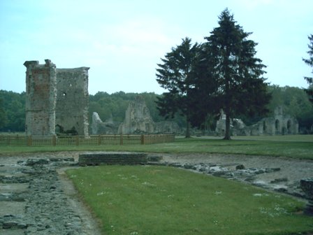
Abbey of Vauclair - from the entrance
Abbey of Vauclair - near the restored medical garden
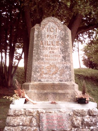
In memory of Ailles - completely erased in the folly of WO-1
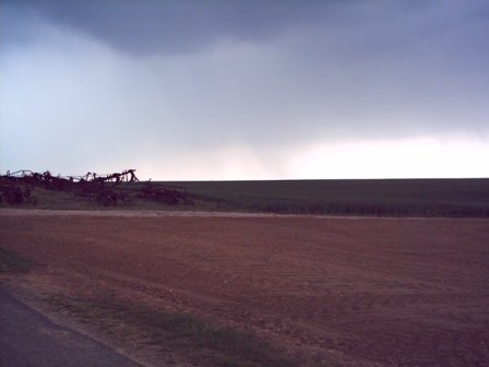
Storm in open field
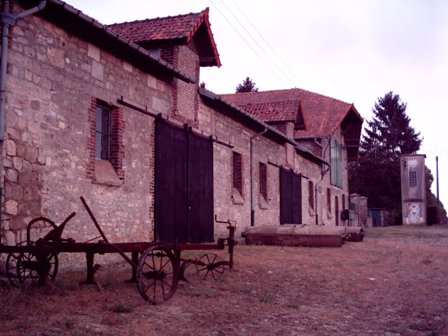
Authentic farms along the way
Gloomy moment near gloomy monument under gloomy weather
"Chemin des Dames" but no more signs of Louis XV's girls
Great spot atop Mt. Faucon (176 metres)
Day 3.7 - Saturday 5th May 2007 - Vendresse-Beaulne to Sancy-les-Cheminots
Via Ostel and Vailly-sur-Aisne (daily total of 20 km).
Breakfast is consumed in Moussy-Verneuil's "lavoir" full with fishes. Supposedly the area we walk through was the arena of the bloody combat of the "chemin des Dames" and everywhere we go we encounter tombs and plaques in memory of fallen heroes. Much nicer is that the road has been used by the girls of Louis XV - Victoire et Adélaïde - to join "la comtess de Narbonne-Lara" in the "château de la Bove". Amongst all memorials we come across a huge artefact, which turns out to be in memory of just 2 guys, being the first pilots who died in aerial combat, as opposed to the hundreds of thousands of infantryman serving as cannon fodder. In Vailly-sur-Aisne we gobbled down a nice lunch, but the owners & customers of the establishment were overly concerned about my dog - never mind me as a the human being - because he didn't look all that fit. Because of the chest injury one of the guys even cut out a hand towel as a shawl for Keanu, so he would hurt his chest any further (remember his wound which was now healing). Those funny French ...
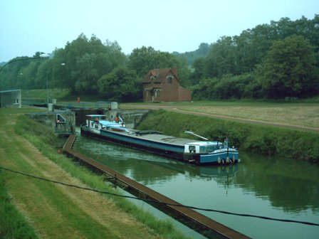
Narrow canal connecting l'Oise with l'Aisne
Memorial for 2 x co- & pilot, at first from afar it looked as if thousands of infantry soldiers died on this spot
Village of Aizy-Jouy
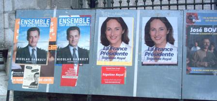
Day 3.8 - Sunday 6th May 2007 - "Presidential Election Day" ends in Soissons
Crossing Vregny, Bucy-le-Long and leaving GR12 at Crouy (daily total of 18 km).
Today France woke up to elect their new president in the final round but I got all stiff and bad tempered having slept on a terribly uneven ground, maybe next time I should exchange the foam for a slightly heavier inflatable mat. Last night we were low on water, but only 250 metres after a curve we found a graveyard offering tap-water. Today was also my last day walking, as I left the GR-12 in Croy to turn to Soisson. One of my first good intentions was to get shaved once I got home, because judging from people's faces I looked a bit rough. However the trip home went smoothly, talking even though no-body really seemed interested in politics. Keanu accepted his muzzle quietly - which is compulsory for dog on French public transport - and via Paris-Nord about 7:15 we drove back with the Thalys into Gare de Midi of Brussels.
"Adore Dieu, observe les Lois, aime ton prochain et ne lui fais que ce que tu voudrais qu'il te fit"
Bucy-le-Long, another quite adorable little town
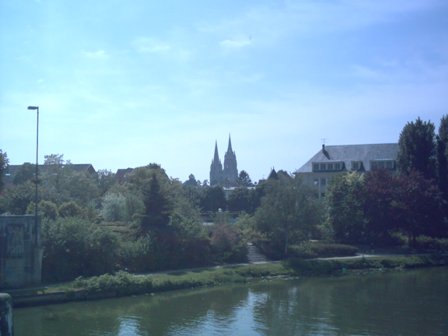
Soissons ... the End is near
Epilogue
On my planning-table I once more over-estimated the number of kilometres someone can walk per day ten eight days in a row with a backpack of 20 kilogram. Definitely 30 kilometres - for me - is overly optimistic, especially if you got to factor in sight-seeing, breaking & setting up camp, getting lost, resting ... The 2 first & last days are even more close to 15 as opposed to 25 kilometres. Sure going faster and stepping longer is possible, but then I would have to loose my dog and not enjoy it that much anyway. So an average of 23 is what I am going to calculate with in future. In mountains it even appears to be far less, on the other hand it is feasible to march 100 kilometres under 24 hours in flat terrain ... so what. Next in Autumn this year or Spring next year I will walk the final 100 kilometres from Soissons to Paris, which will take me along the Pierrefond, and the Forêt de Compiégne and Chantilly ... Keep Walking !!!
Navigational Statistics & References
Total distance of 155 km has been covered in 7 days effective walking, thus averaging 22 km/day. Grand total distance of 390 km in 17 days when including 2005 (start in Brussels) and 2006, levelling average at 23 km/day in sometimes heavily forested and muddy terrain, from which 1 quarter relatively hilly (i.e. frequent ups & downs of more then 50 metres) near BE/FR-border and near valleys of numerous rivers.
There does not seem to be an official Topo-Guide covering GR12 between Rocroi and Amifontaine. However an alternative track from Amifontaine to Belgium can be found in GR654 "de Namur à Nevers". 3 maps for IGN (Institut Geographique National) at scale 1:100.000 have been used, i.e. 05 Charleville-Mézières/Maubeuge, 10 Reims/Verdun and 09 Paris/Laon. Between Amifontaine and Senlis you can use the Topo-Guide "Les GR de Picardie" which includes 7 other itinaries + 2 variations on the GR12 (GR12A via Fourche de la Bécasse & GR12B via Ponte Sainte-Maxence).